| Kyalu | |||||
|---|---|---|---|---|---|
| |||||
| Motto Carpe trito vestigial (Travel the unmarked trail) |
|||||
| National Anthem "I Am Kyalutian" | |||||
 |
|||||
| Capital | Stanley | ||||
| Largest City | Seattle | ||||
| Official languages | None | ||||
| Recognized regional languages | English (de facto) | ||||
| Demonym | Kyalutian | ||||
| Government | Federal republic | ||||
| - President | Derek Woo | ||||
| - Executive | Cabinet | ||||
| - Legislative | Congress | ||||
| - Judicial | Supreme Court | ||||
| Formation - Foundation |
May 2, 2011 |
||||
| Major Religions | None | ||||
| National Animal | Blue Heron | ||||
| Total Area | 407.6km² | ||||
| Total Population - Ethnic Groups |
9 178 American, Canadian, English, Italian, German, Spanish, Portuguese, Greek, Mexican, Chinese, Vietnamese, Indian, Korean, Japanese, Russian, Ukrainian, other |
||||
| Currency | Kyalutian dollar ($) (KYD) | ||||
| Nominal GDP - Total - Per Capita |
2011 estimate $1.16 million $1062.78 |
||||
| Literacy Rate | 66.80% | ||||
| Internet TLD | .ku | ||||
| Driving Lane | Right | ||||
| Date Format | dd/mm/yyyy (AD) | ||||
| Time Zone | UTC-8 | ||||
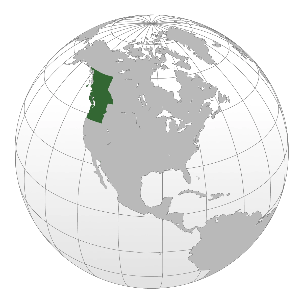
Kyalu is a Cascadian country in western North America. It is the largest of all Cascadian nations. The nation was formed after the declaration of independence and signing of the Treaty of Stanley by Washington, Oregon, and British Columbia. It has a member seat in the New Pacific Order, and is a signatory of the Sunshine Treaty Organization Pact.
Kyalu is bordered by Gauntletia to the south, the United States of America to the east, and Canada to the north. To the west is the Pacific Ocean, the world's largest body of water. The nation has a total population of 9 178 people, and is approximately 407 square kilometres.
Kyalu is a federal state governed as a presidential democracy. It is comprised of five provinces and one territory. Provinces are further divided into counties, each of which seats one elected representative into the lower house, known as the House of Representatives. Maple Territories, the only Kyalutian territory, seats a total of three elected representatives.
Kyalu has an economy that is reliant of its two main resources, oil and rubber, a majority of which is exported to the United States of JBR and other members of the Sunshine Treaty Organization Pact. The nation has a total GDP of $1.23 million.
Etymology[]
The name Kyalu derives from the Haida word k'yaal uu, which means blue heron. The Haida were one of the many Early Cascadian groups which inhabited the modern-day Kyalu. Although the original draft of the Treaty of Stanley referred to the nation as the Cascadian States of Kyalu, it was eventually shortened to Kyalu.
Citizens of Kyalu are generally referred to as Kyalutians, although the term Cascadian and Pacific Northwesterner is used frequently.
History[]
Indigenous People[]
With a history of human occupation spanning many millennia, and the incredible richness of Pacific Northwest fisheries (salmon, etc.), it is not surprising that the tribes who occupied the area historically were some of the most complex hunter-gatherer-fishers in history. They lived in large villages or towns, built plank houses and large canoes, and had sophisticated artistic and technological traditions. In Lower and Maple Territory, for instance, maritime tribes like the Tlingit and Haida erected the large and elaborately carved totem poles that are iconic of Pacific Northwest artistic traditions. Throughout the area, thousands of descendants of these proud Pacific Northwest tribes still live and many of their cultural traditions continue to be practiced.
Initial Exploration[]
British explorer Francis Drake sailed off the coast of Oregon in 1579. In 1592, the Strait of Juan de Fuca was discovered by Juan de Fuca. During the early 1740s, Imperial Russia sent Dane Vitus Bering to the region, and by the 19th century, Russian settlers had established several communities on the Pacific coast.
In 1792, George Vancouver charted the Pacific Northwest, including the Strait of Georgia, Puget Sound, and much of the Kyalutian coast. For him the Province of Vancouver is named. On June 21, 1792, Vancouver encountered two Spanish schooners, which had previously discovered the Fraser River. After sharing maps and agreeing to cooperate, the three ships sailed north, passing Johnstone Strait before returning to Nootka Sound, which had been discovered by Spanish explorers several years before.
Canada and the United States[]
After the declaration of independence by the United States of America, Washington State and Oregon became states of the United States of America, and with the joining of the Canadian Confederation by British Columbia, it became a Canadian province.
April Revolution[]
The April Revolution originated in British Columbia as citizens were exasperated with the provincial government, which they believed were out of touch with middle-class workers. Strikes, protests, and riots broke out in Vancouver on April 5, 2011, and soon after, additional cities such as Richmond, Burnaby, Prince George joined in, and it became clear that it was a province-wide revolution. Word of the revolution quickly spread South, as citizens of the American states of Washington and Oregon also began to grow dissatisfied with their local governments and began to revolt.
On April 20, 2011, British Columbian Premier Christy Clark resigned, as rioters in Victoria, BC entered the British Columbian Parliament buildings, forcing her to evacuate the building and leave the province. An interim government lead by Jake Witherspoon was created, and remained in office for nine days before the national capital was moved to Vancouver, where power was transferred to Derek Woo, the current President of Kyalu.
Two days after the fall of Christy Clark, Oregonian Governor John Kitzhaber also resigned, as an ultimatum was thrown through the window of his office by protesters, demanding that he step down as Governor. Kitzhaber was evacuated from the state on a private helicopter chartered by the protesters. Protesters proceeded to enter the Capitol building and set up an interim government lead by James Thompson, which would stay in office for eleven days.
Last to fall was Washington State Governor Christine Gregoire. After Kitzhaber's resignation, Gregoire quickly realized that her power would soon be lost, as two of her state's three land borders were governed by revolutionaries. On April 23, Gregoire privately recorded a video of resignation in her private office, and left the Washington State Capitol building on a military helicopter. After viewing the tape, the protesters proceeded to instate an interim government lead by Maria Fell, which would last for ten days.
Treaty of Stanley[]
- Main article: Treaty of Stanley
On April 29, 2011, official talks between Derek Woo, James Thompson, and Maria Fell began in Vancouver, British Columbia. The closed-door meetings lasted three days before a public announcement was made on the morning of May 1, 2011, stating that an agreement had been reached, and would be officially announced at 10PM.
At 9:55PM, May 2, 2011, Derek Woo, James Thompson, and Maria Fell approached three pedestals on the lawn of the Vancouver Convention Centre. At 10:00PM, Derek Woo announced that an agreement had been reached by the three parties involved. After an expression of gratitude towards all supporting revolutionaries and an explanation of the situation, the announcement was made that a treaty had been finalized, and would be signed by at midnight the following day.
At 11:30PM, the Treaty of Stanley was revealed to the public, and the three leaders made introductory explanations of the terms stated in the treaty. It would create three independent states, then unite them into one nation named Kyalu. Derek Woo would be named leader of the new nation, while James Thompson and Maria Fell would be named advisors. At exactly 12:00AM, the leaders simultaneously signed the Treaty of Stanley.
Modern Kyalu[]
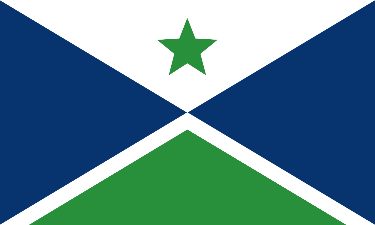
With the signing of the Treaty of Stanley, British Columbia, Washington State, and Oregon officially became one nation, officially named Kyalu. An interim flag was adopted as the national flag of Kyalu, but was replaced after a new one was chosen after the Kyalutian flag debate on May 8, 2011. The nation was divided into five provinces and one territory.
On May 10, 2011, a legislation was passed for adopting several socially democratic programmes, such as universal health care, a pension plan, and student loans nationwide.
Original claims of Southern California and Baja California by Kyalu were eventually ceded after being contested by the United States of JBR.
Geography and Geology[]
The Pacific Northwest is a diverse geographic region, dominated by several mountain ranges, including the Coast Mountains, the Cascade Range, the Olympic Mountains, the Columbia Mountains, and the Rocky Mountains. The highest peak in the Pacific Northwest is Mount Rainier, in the Washington Cascades, at 14,410 feet (4,392 m). Immediately inland from the Cascade Range there is a broad plateau, narrowing progressively northwards, only a few miles wide in Lower Maple, and also getting higher. In Pacifica, this region often completely arid, is known as the Columbia Plateau, while in the Maples it is the Interior Plateau, also called the Fraser Plateau. The Columbia Plateau was the scene of massive ice-age floods, as a consequence there are many coulees, canyons, and plateaus. Much of the plateau, especially in eastern Pacifica, is irrigated farmland. The Columbia River cuts a deep and wide gorge around the rim of the Columbia Plateau, and through the Cascade Range on its way to the Pacific Ocean. After the Mississippi, more water flows through the Columbia than any other river in the Kyalu.
Because many areas have plentiful rainfall, the Pacific Northwest has some of North America's most lush and extensive forests, and at one time, the largest trees in the world. Coastal forests in some areas are classified as temperate rain forest, or in some local slang, "cold jungle".
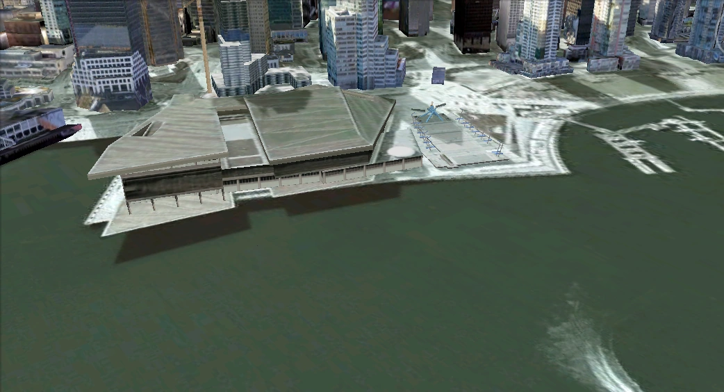
The major cities of Stanley, Portland, Seattle and Tacoma all began as seaports supporting the logging, mining, and farming industries of the region, but have developed into major technological and industrial centers (such as the Silicon Forest), which benefit from their location on the Pacific Rim.
The Pacific Northwest is still highly geologically active, with both active volcanoes and geologic faults. Active volcanoes in the region include Mount Garibaldi, Mount Baker, Mount Rainier, Mount Saint Helens, which erupted in 1980, Mount Hood, Mount Jefferson, and Mount Shasta.
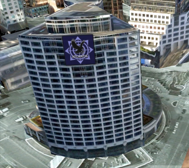
Government and Elections[]

K3 House in Stanley, Kyalu.
Kyalu is a federal republic and representative democracy.
The federal government is composed of three branches:
- Legislative: The bicameral Congress, made up of the Senate and the House of Representatives, makes federal law, declares war, approves treaties, has the power of the purse, and has the power of impeachment, by which it can remove sitting members of the government.
- Executive: The president is the commander-in-chief of the military, can veto legislative bills before they become law, and appoints the members of the Cabinet (subject to Senate approval) and other officers, who administer and enforce federal laws and policies.
- Judicial: The Supreme Court and lower federal courts interpret laws and overturn verdicts when deemed appropriate.
The provincial governments are structured in roughly similar fashion while Maple Territories has a unique unicameral legislature. The governor (chief executive) of each province is directly elected. Some provincial judges and cabinet officers are appointed by the governors of the respective province, while others are elected by popular vote.
Economy[]
- Main article: Economy of Kyalu
Kyalu has a capitalist mixed economy, which is fueled by its natural resources, a well-developed infrastructure, and high productivity. The economy of Kyalu depends heavily on its two resources, Oil and Rubber. Kyalu's economy employs approximately 89% of the Kyalutian population, leaving a 11% unemployment rate. Kyalu's economy has a GDP of $1.16 million annually.
Free trade agreements are in place between Kyalu and other members of the Sunshine Treaty Organization Pact.
Currency[]
- Main article: Currency of Kyalu
The currency used in Kyalu is the Kyalutian Dollar (KYD), issued by the Bank of Kyalu. Bank notes are issued in denominations of $100, $50, $20, $10, $5 and $1, while coins are issued in denominations of $2, $1, $0.25, $0.10, $0.05, and $0.01. The Kyalutian dollar is valued, as of May 2011, at approximately $105KYD per $100USD.
Foreign Relations and Military[]
International Relations[]
- See also: Foreign Relations of Kyalu

Embassy of the Pacific Empire in Stanley, Kyalu.
The foreign affairs of Kyalu is the responsibility of the Bureau of Foreign Affairs. Kyalu has a member seat in the New Pacific Order, and is a signatory of the Sunshine Treaty Organization Pact. Kyalu has formal relations with the Pacific Empire, Bobogoobo, Anyplace, the United States of JBR and the Republic of Bekolan.
Military[]
- See also: Kyalutian Forces
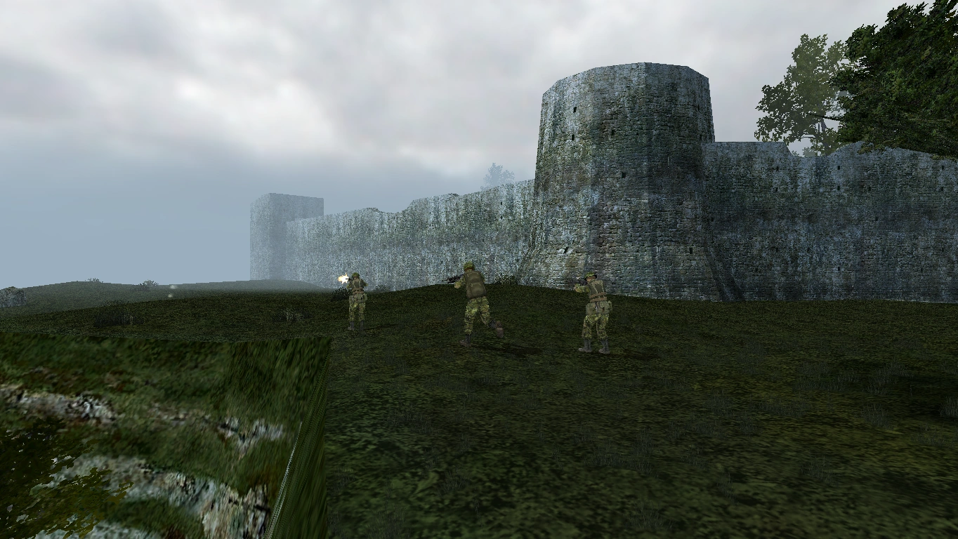

Kyalutian infantry during the Kyalutian-Kano War.
The president holds the title of commander-in-chief of the Kyalutian Forces and appoints its leaders, the secretary of defense and the Joint Chiefs of Staff. The Bureau of Defense administers both the Expeditionary Command and Kyalu Command, though the elite K4 Command reports directly to the secretary of defense.

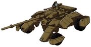
Sturmpanzer II
The Kyalutian Forces are a single, unified service that consists of two main Commands, the Expeditionary Command and Kyalu Command, consisting of a total of 400 members. It is currently involved in the Kyalutian-Gro Westfahlen and Kyalutian-Regonian Wars. The KF does not possess any battleships, aircraft, cruise missiles, or nuclear weapons. Due to its secrecy, the military budget of Kyalu is unknown. As of June 4, 2011, the Kyalutian Forces has suffered 3,524 military casualties in total.
Currently, the Pacific Empire is exporting military products to the Kyalutian Forces and is the biggest supplier of military hardware and equipment to Kyalu.
| Current Signatories | |
|---|---|
|
|
| Former Signatories | |
|
|
| Observers | |
| Former Observers | |
| Self-Declared Signatories | |
|
|
| ||||||||||||||
