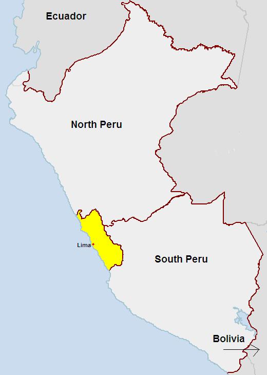
Map of Peru
The Peru Pact was a document signed by King Michel I of New Arundel and King Allen of the Floridian Empire on June 24, 2007. The pact set the borders for the former nation of Peru to make the new colonies of North Peru and South Peru. The Peruvian Lima Territory will be shared between North and South Peru.
The signing rulers of the two nations, New Arundel & the Floridian Empire, do hereby agree to claim Peruvian lands only allowed within the areas stated in this pact. Lima Territory shall be a shared territory between North and South Peru. Lima may serve as a colonial territory for North or South Peru if wished. If both colonies claim Lima as their capital, there will be NO conflict and the colonies may share the city.
New Arundel will receive northern Peru and may name it whatever it likes. New Arundel will also receive Ecuador as a colony. The Eastern Galapagos Islands will become a territory of North Peru.
The Floridian Empire will receive southern Peru and may name it whatever it likes. The Floridian Empire will also receive Bolivia as a colony. The Western Galapagos Islands will become a territory of South Peru.
On the map provided, areas only include the Peru Territory. The yellow area is a shared territory between the two colonies. The red dot is the City of Lima.
Signed by the leaders of New Arundel and the Floridian Empire
- King Michel I of the Grand Kingdom of New Arundel
- King Allen of the Floridian Empire